
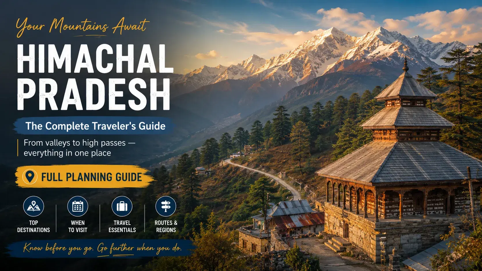
Himachal Pradesh is a Himalayan state in northern India, covering 55,673 sq km across 12 administrative districts, with altitudes ranging from 350 m to 6,816 m. This Himachal Pradesh travel guide addresses the core planning problem: the state contains four distinct geographic circuits, each with different seasons, road conditions, and permit requirements. Treating all four circuits as a single destination produces poorly timed, logistically flawed itineraries. This article covers the four circuits, best travel seasons, transport options, permit requirements, realistic costs, and the HP-4 Circuit Planning System — a structured framework for building a sound Himachal Pradesh itinerary from first principles.
What is Himachal Pradesh as a travel destination?
Himachal Pradesh is a Himalayan state in northern India covering 55,673 sq km across 12 administrative districts, with altitudes ranging from 350 m to 6,816 m. The state divides into four distinct geographic circuits, each requiring separate planning for seasons, road access, and permits.
Lower Himachal Circuit
The Lower Himachal Circuit encompasses Shimla, Dharamshala, Dalhousie, and the Kangra Valley at elevations between 1,400 m and 2,200 m. This circuit is accessible year-round and suits first-time visitors to the region. Shimla is the former British summer capital of India, connected to Kalka by the UNESCO World Heritage-listed narrow-gauge Kalka-Shimla Railway. Dharamshala, at 1,457 m, hosts the Central Tibetan Administration, the seat of the Tibetan government-in-exile. Dalhousie sits in Chamba district at 2,036 m and retains colonial-era architecture.
Kullu-Manali Circuit
The Kullu-Manali Circuit covers Kullu Valley, Manali, Parvati Valley, and Kasol, with valley floors at 1,200–2,050 m and passes reaching 3,978 m. Manali is an adventure hub in Kullu district at 2,050 m elevation. Kasol is a Parvati Valley village at 1,640 m serving as a trekking base for Kheerganga and Pin-Parvati Pass routes. Bir Billing, in Kangra district at 1,525 m, is an internationally recognised paragliding site that has hosted the Paragliding World Cup.
Lahaul-Spiti Circuit
The Lahaul-Spiti Circuit is a cold desert high-altitude zone receiving fewer than 170 mm of annual precipitation. Kaza is the administrative headquarters of Spiti Valley at 3,800 m elevation. Chandratal Lake sits at 4,300 m with seasonal road access from May to October only. Key Monastery is a 13th-century Tibetan Buddhist monastery at 4,166 m. Tabo Monastery, founded in 996 CE, is protected under the Archaeological Survey of India.
Kinnaur Circuit
Kinnaur is a border district adjoining Tibet, spanning elevations from 1,800 m to 6,000 m. The district is known for Kinnauri shawls and apple orchards. An Inner Line Permit is mandatory for Indian nationals travelling beyond Sangla toward Shipki La.
Circuit | Key Towns | Elevation Range | Road Access Season | Permit Required |
|---|---|---|---|---|
Lower Himachal | Shimla, Dharamshala, Dalhousie | 1,400–2,200 m | Year-round | None |
Kullu-Manali | Manali, Kasol, Bir | 1,200–3,978 m | March–November (passes) | NGT permit for Rohtang Pass |
Lahaul-Spiti | Kaza, Tabo, Chandratal | 3,800–4,300 m | May–October | ILP for restricted border zones |
Kinnaur | Sangla, Kalpa, Nako | 1,800–6,000 m | April–November | ILP beyond Sangla |
What is Himachal Pradesh as a Travel Destination?
Himachal Pradesh is a Himalayan state in northern India covering 55,673 sq km across 12 administrative districts. The state spans altitudes from 350 m in Una district to 6,816 m at Reo Purgyil peak, dividing naturally into four distinct geographic circuits, each requiring separate planning for seasons, permits, and road access.
Himachal Pradesh borders Jammu and Kashmir to the north, Punjab and Haryana to the west, Uttarakhand to the east, and Tibet to the northeast. This geographic position creates four circuits with fundamentally different climates, accessibility windows, and logistical requirements within a single state boundary.
The state receives over 15 million domestic and international visitors annually. Treating Himachal Pradesh as a single uniform destination is the most common planning error. A traveller planning Spiti Valley and Shimla in the same week faces incompatible road conditions, permit requirements, and altitude profiles.
The four circuits — Lower Himachal, Kullu-Manali, Lahaul-Spiti, and Kinnaur — form the structural basis of any sound Himachal Pradesh travel guide. Each circuit is addressed separately in the sections that follow.
Why does Himachal Pradesh matter for Indian travellers?
Himachal Pradesh matters for Indian travellers because the state offers the most accessible high-altitude Himalayan terrain in India, with road and rail connections from Delhi, Chandigarh, and Amritsar reaching major destinations within 8 to 14 hours at moderate cost.
Himachal Pradesh is a northern Indian Himalayan state covering 55,673 sq km across 12 administrative districts. The state sits within a 10–14 hour surface journey from the National Capital Region, making Himachal Pradesh the primary Himalayan destination for over 15 million domestic visitors annually.
Indian travellers do not require a passport or foreign exchange to visit Himachal Pradesh. The state delivers high-altitude landscapes, Buddhist monasteries, and alpine trekking routes at a fraction of the cost and logistical complexity of international mountain destinations. Budget travellers can complete a 7-day Shimla-Manali circuit for under ₹15,000 including transport and accommodation.
Himachal Pradesh also serves distinct traveller profiles within a single state boundary. Families with children access Lower Himachal hill stations at elevations between 1,400 m and 2,200 m without altitude risk. Adventure travellers reach Spiti Valley at 3,800 m to 4,500 m for cold-desert trekking and high-pass motorcycle routes. Pilgrims visit Tibetan Buddhist monasteries including Tabo Monastery, founded in 996 CE, and Key Monastery at 4,166 m in Spiti.
The Kalka-Shimla Railway, a UNESCO World Heritage Site, provides a heritage rail approach to Shimla that no other Indian hill state replicates. Dharamshala hosts the Central Tibetan Administration, making Himachal Pradesh the seat of a living Tibetan cultural ecosystem within India.
For Indian travellers comparing domestic mountain options, Himachal Pradesh combines accessibility, circuit variety, and cost efficiency in a single state — a combination that Uttarakhand, Sikkim, and Ladakh each offer only partially.
How does planning a Himachal Pradesh trip work step by step?
Planning a Himachal Pradesh trip requires sequencing four decisions in order: circuit selection, travel window validation, transport booking, and permit acquisition. Skipping any step creates logistical gaps that cannot be resolved after arrival in the state.
Step 1 — Choose your circuit and travel window
The HP-4 Circuit Planning System begins with Zone Mapping. A traveller must classify the trip by one or more of the four geographic circuits before selecting dates.
The Manali–Spiti–Shimla loop is the most popular multi-circuit route in Himachal Pradesh. This loop combines the Kullu-Manali Circuit with the Lahaul-Spiti Circuit and exits through Lower Himachal. The loop requires a minimum of 12 days to complete without altitude risk.
Single-circuit trips are simpler to plan. A Lower Himachal circuit covering Shimla and Dharamshala is accessible across most of the year. A Lahaul-Spiti circuit is accessible only between late May and late October.
Step 2 — Getting to Himachal Pradesh
Himachal Pradesh is served by three airports, two rail entry points, and multiple national highway corridors from Delhi and Chandigarh.
By air, Kullu-Manali Airport at Bhuntar (IATA: KUU) receives daily flights from Delhi. Gaggal Airport near Dharamshala (IATA: DHM) serves the Lower Himachal northern zone. Shimla Airport (IATA: SLV) operates limited scheduled services.
By road from Delhi to Manali, the standard route follows NH-44 to Chandigarh then NH-3 via Mandi. The total distance is approximately 540 km. HRTC Volvo overnight buses from Delhi ISBT Kashmere Gate complete this route in approximately 13 hours.
By road from Delhi to Shimla, the route follows NH-44 to Chandigarh then NH-5. The total distance is approximately 370 km, requiring 8 to 9 hours by road.
The Kalka-Shimla Railway — a UNESCO World Heritage narrow-gauge line covering 96 km through 102 tunnels — provides a heritage rail approach to Shimla from Kalka junction.
Step 3 — Getting Around Within Himachal Pradesh
Getting around Himachal Pradesh requires matching the transport mode to the circuit. HRTC operates over 3,200 bus routes across the state, making it the most economical option for Lower Himachal and Kullu-Manali. Frequency drops sharply above 3,000 m in Spiti and Kinnaur.
Shared taxis are the standard mode in Spiti Valley and Kinnaur, where bus schedules are limited to one or two departures daily. Self-drive vehicles and rented motorcycles suit the Spiti circuit. Any vehicle crossing high-altitude passes requires a valid fitness certificate.
Rohtang Pass, the 3,978 m pass connecting Kullu Valley to Lahaul-Spiti, requires an NGT day permit for private vehicles. The permit is booked online via himachalecotourism.in. The NGT limits private vehicle entry to approximately 1,200 vehicles per day.
Step 4 — Permits and Compliance
Permit requirements in Himachal Pradesh vary by zone and nationality. Indian nationals require an Inner Line Permit to enter restricted border areas in Spiti, Kinnaur, and Lahaul. Foreign nationals require an additional Restricted Area Permit from the Ministry of Home Affairs.
The Inner Line Permit applies to zones beyond Losar in Spiti and beyond Sangla toward Shipki La in Kinnaur. Travellers obtain the ILP from Sub-Divisional Magistrate offices in Kaza or Reckong Peo. The permit is also available through the Himachal Pradesh government portal at himachal.nic.in.
Obtaining permits in the correct sequence is the third component of the HP-4 Circuit Planning System. Applying for the ILP before booking accommodation in Kaza or Nako avoids itinerary disruptions. Rohtang NGT permits must be booked separately and in advance of the pass crossing date.
What are the most common mistakes when planning a Himachal Pradesh travel guide itinerary?
The most common mistakes in Himachal Pradesh trip planning include ignoring circuit-specific road conditions, skipping permit applications, underestimating altitude gain, and booking accommodation before confirming pass accessibility for the chosen travel window.
Treating Himachal Pradesh as a single destination: The state spans four distinct circuits with separate access seasons. A Spiti Valley itinerary requires different dates, permits, and logistics than a Shimla or Dharamshala trip.
Skipping the Season-Gate Check: Travellers book flights to Kullu-Manali Airport before confirming whether Rohtang Pass is open. The pass typically opens in May and closes in November. Booking before verifying BRO road-opening dates causes itinerary failure.
Ignoring the Inner Line Permit sequence: The Inner Line Permit is mandatory for Indian nationals entering restricted zones in Spiti and Kinnaur. Applying for the ILP after booking accommodation in Kaza creates avoidable delays at checkpoints.
Ascending too fast above 2,500 m: The HP-4 Circuit Planning System specifies a maximum elevation gain of 500 m per day above 2,500 m. Travellers who drive directly from Manali to Kaza in one day risk acute mountain sickness.
Underestimating road travel time in high-altitude zones: Road distances in Spiti and Kinnaur are short on paper. However, mountain road conditions reduce average speeds to 20–30 km per hour on many segments.
Booking only one transport option for Spiti: HRTC bus frequency drops sharply above 3,000 m. Travellers relying solely on buses without a shared taxi backup face long waits at remote junctions such as Losar or Sumdo.
How do you use the Tripstor Planning Framework to build a Himachal Pradesh travel guide?
The Tripstor Planning Framework applies the HP-4 Circuit Planning System to structure a Himachal Pradesh travel guide across four sequential steps: Zone Mapping, Season-Gate Check, Permit and Compliance Stack, and Altitude Progression Plan. Each step produces a verified input for the next, reducing itinerary failure caused by skipped logistics.
The framework treats Himachal Pradesh not as a single destination but as four distinct geographic circuits. Each circuit carries its own access season, permit requirements, and altitude profile. Combining circuits without running all four components is the primary cause of booking errors.
Zone Mapping identifies which of the four circuits — Lower Himachal, Kullu-Manali, Lahaul-Spiti, or Kinnaur — the itinerary covers. The Season-Gate Check then validates that every selected circuit is road-accessible in the chosen travel window. The Permit and Compliance Stack lists all required documents — ILP, NGT Rohtang permit, forest permits — in the correct application sequence. The Altitude Progression Plan then builds the day-by-day elevation schedule, capping gain at 500 m per day above 2,500 m.
A traveller planning a Manali-to-Kaza loop in late May would run Zone Mapping first, flagging both Kullu-Manali and Lahaul-Spiti circuits. The Season-Gate Check would confirm Rohtang Pass and Kunzum Pass opening dates via BRO. The Permit Stack would generate an ILP application before accommodation is booked in Kaza. The Altitude Plan would insert a mandatory acclimatisation night in Manali before ascending to Kaza at 3,800 m.
Using this sequence converts a generic Himachal Pradesh travel guide into a circuit-specific, permit-compliant, altitude-safe itinerary with no dependency gaps.
How do you use the Tripstor Planning Framework to build a Himachal Pradesh travel guide?
The Tripstor Planning Framework applies the HP-4 Circuit Planning System to convert a generic himachal pradesh travel guide into a structured, circuit-specific itinerary. The framework takes four inputs — zone, season, permits, and altitude — and outputs a booking-ready plan with no dependency gaps.
Each component addresses a distinct failure point. Zone Mapping assigns the trip to one or more of the four geographic circuits before any dates are chosen. The Season-Gate Check then validates road and pass accessibility for the selected circuits. The Permit and Compliance Stack sequences all required documents — ILP, NGT Rohtang permit, forest permits — in the correct application order. The Altitude Progression Plan caps daily elevation gain at 500 m above 2,500 m and inserts mandatory acclimatisation stops.
A traveller using this framework for a Shimla-to-Kaza itinerary would begin Zone Mapping by flagging both the Lower Himachal and Lahaul-Spiti circuits. The Season-Gate Check would confirm the Shimla–Kaza highway via Kinnaur is accessible in the chosen window. The Permit Stack would generate an ILP application before accommodation in Kaza is booked. The Altitude Plan would insert a rest day at Rekong Peo before ascending to Kaza at 3,800 m.
Running all four components in sequence removes the most common cause of booking errors: selecting dates before confirming road access, or booking accommodation before confirming permit eligibility.
>
HP-4 Component | Input Required | Output Produced |
|---|---|---|
Zone Mapping | Desired destinations listed by name | Circuit classification: Lower Himachal, Kullu-Manali, Lahaul-Spiti, or Kinnaur |
Season-Gate Check | Target travel window (month and year) | Pass and road accessibility status for each assigned circuit |
Permit and Compliance Stack | Circuit classification and nationality of traveller | Sequenced permit list: ILP, NGT Rohtang permit, forest permits in correct application order |
Altitude Progression Plan | Circuit route with elevation data per stop | Day-by-day itinerary capping elevation gain at 500 m above 2,500 m with acclimatisation stops inserted |
The table above maps each component to its required input and its concrete output. A traveller can treat each row as a checklist item. Completing all four rows in sequence produces a logistically sound itinerary before any booking is confirmed.
Worked Example: Applying the HP-4 System to a 10-Day Manali–Spiti Loop
The following example applies all four HP-4 components to a single real itinerary. Each component produces a concrete numeric output that directly shapes the next planning decision.
Zone Mapping output: The traveller selects Manali, Kaza, and Chandratal Lake. Zone Mapping classifies this as a dual-circuit trip spanning Kullu-Manali and Lahaul-Spiti.
Season-Gate Check input is a June travel window. Rohtang Pass at 3,978 m typically opens in mid-May. Kunzum Pass at 4,590 m opens in early June. Both passes are confirmed accessible, so the circuit is viable.
The Permit and Compliance Stack identifies two required documents. An NGT Rohtang Pass permit must be booked online at himachalecotourism.in at least 24 hours before travel. An Inner Line Permit for Spiti is obtained from the Sub-Divisional Magistrate office in Kaza or Reckong Peo before crossing Losar.
The Altitude Progression Plan applies the 500 m per day cap above 2,500 m. The resulting day-by-day structure looks like this:
Day 1: Arrive Manali — elevation 2,050 m; rest day, no ascent
Day 2: Manali to Rohtang Pass crossing to Gramphu — elevation gain approximately 1,928 m in transit, but overnight stop at Gramphu at 3,150 m keeps sleeping altitude within range
Day 3: Gramphu to Losar — elevation 4,079 m; gain of 929 m; one acclimatisation stop at Chandra Taal road junction inserted
Day 4: Losar to Kaza — elevation 3,800 m; descent of 279 m; rest day in Kaza mandatory before further ascent
Day 5–6: Kaza day trips to Key Monastery at 4,166 m and Hikkim village at 4,400 m; sleeping altitude remains 3,800 m
Day 7: Kaza to Chandratal Lake — elevation 4,300 m; gain of 500 m exactly, meeting the daily cap
Day 8–10: Return via Manali or Shimla route depending on road status
This 10-day structure covers 620 km of mountain road, requires two permits, and inserts three mandatory acclimatisation stops. Without the HP-4 framework, most travellers attempt Kaza on Day 3, which places them at 3,800 m after a single night at 2,050 m — a common cause of acute mountain sickness on this circuit.
What advanced strategies do experts use when planning a Himachal Pradesh trip?
Expert planners approach a Himachal Pradesh trip by layering four decisions in sequence: circuit selection, season validation, permit acquisition, and altitude progression. Skipping any layer or reordering the sequence produces itineraries that fail at the logistics stage rather than on the ground.
The first advanced strategy is circuit-locking before date selection. Most travellers choose dates first and then select destinations, which is the reverse of the correct order. The Lahaul-Spiti circuit, for example, has a hard road-access window governed by Kunzum Pass and Rohtang Pass conditions. Choosing October as a travel month and then selecting Chandratal Lake as a destination creates a high probability of road closure. Expert planners identify the circuit first, then consult BRO pass-opening records to set the travel window.
The second strategy is permit pre-staging. The Inner Line Permit for Spiti and the NGT day permit for Rohtang Pass operate on separate systems. The Rohtang permit is issued online via himachalecotourism.in with a daily vehicle cap of approximately 1,200 units. Demand on peak summer days exceeds supply. Experts book the Rohtang permit 48–72 hours in advance and build the itinerary backward from that confirmed date rather than treating the permit as an afterthought.
The third strategy involves elevation-anchored accommodation selection. Rather than choosing hotels by comfort rating or price, expert planners select sleeping-altitude first. A traveller moving from Manali at 2,050 m toward Kaza at 3,800 m must sleep at an intermediate elevation of approximately 3,150 m on the first night. Gramphu serves this function. Accommodation availability at Gramphu is limited, so booking it before any other property on the circuit is the correct sequence.
Advanced strategies — second half
The final three advanced strategies for Himachal Pradesh trip planning address contingency routing, acclimatisation scheduling, and exit-point flexibility. Planners who apply all six strategies together reduce itinerary failure rates caused by road closures, permit gaps, and altitude illness.
The fourth strategy is contingency route mapping. Every high-altitude circuit in Himachal Pradesh has one primary road and, in most cases, one alternate. The Manali–Kaza route via Rohtang Pass and Kunzum Pass is the primary Spiti entry. The Shimla–Kaza route via Kinnaur is the alternate. Expert planners pre-research both routes before departure. If BRO closes Kunzum Pass, the Shimla route remains viable.
The fifth strategy is acclimatisation day insertion. The HP-4 Circuit Planning System requires that elevation gain above 2,500 m does not exceed 500 m per day. Planners insert a zero-movement day at Kaza before ascending toward Chandratal Lake at 4,300 m. This single inserted day reduces acute mountain sickness risk significantly on the Spiti circuit.
The sixth strategy is exit-point pre-booking. Himachal Pradesh circuits often end at a different point from where they begin. The Manali–Spiti–Shimla loop ends in Shimla, not Manali. A traveller who pre-books a return flight from Bhuntar Airport near Kullu is stranded if the itinerary concludes in Shimla. Expert planners confirm the circuit's terminal town before booking any onward transport. Shimla connects to Chandigarh by road in approximately four hours, making Chandigarh the most reliable exit hub for multi-circuit trips.
Applied together, these six strategies form a complete pre-departure checklist. Circuit identification, permit pre-staging, elevation-anchored accommodation, contingency routing, acclimatisation scheduling, and exit-point pre-booking address every major failure mode in Himachal Pradesh trip planning.
Conclusion: Applying the HP-4 Circuit Planning System to Your Himachal Pradesh Travel Guide
A complete Himachal Pradesh travel guide is not a list of attractions. It is a structured planning document built around four geographic circuits, each with distinct seasons, permits, and altitude profiles. The HP-4 Circuit Planning System provides the framework: Zone Mapping, Season-Gate Check, Permit and Compliance Stack, and Altitude Progression Plan. Travellers who apply all four components before booking reduce itinerary failure risk substantially.
The six pre-departure strategies covered in this guide — circuit identification, permit pre-staging, elevation-anchored accommodation, contingency routing, acclimatisation day insertion, and exit-point pre-booking — translate the HP-4 framework into actionable steps. Each strategy addresses a specific failure mode documented across Himachal Pradesh circuits.
Himachal Pradesh rewards structured preparation. A traveller who maps the correct circuit, validates seasonal access, secures permits in sequence, and builds elevation gain within safe daily limits will complete the intended itinerary. A traveller who skips any one of these steps risks road closures, permit refusals, or altitude illness. This himachal pradesh travel guide exists to close that gap between intention and execution.
Ready to Plan Your Trip?
Himachal Pradesh rewards travellers who approach the state as a structured planning exercise rather than a spontaneous destination. Applying the HP-4 Circuit Planning System — Zone Mapping, Season-Gate Check, Permit and Compliance Stack, and Altitude Progression Plan — before booking converts a complex, multi-region itinerary into a manageable sequence of decisions. Each circuit in this himachal pradesh travel guide carries distinct access windows, permit requirements, and elevation profiles that must be matched to the traveller's available dates and physical readiness.
Tripstor's travel consultants specialise in building Himachal Pradesh itineraries across all four circuits. A consultant will validate your circuit selection against current road and permit conditions, sequence your permits correctly, and insert acclimatisation stops at the elevations where altitude illness risk is highest. The result is an itinerary that accounts for every logistical variable documented in this guide — before you depart, not after a problem arises on the road.
Speak with a Tripstor Himachal Pradesh specialist: +91-9825343323. Consultants are available to map your circuit, confirm seasonal access, and build a permit-compliant itinerary tailored to your travel window.